Ophelia
19 September 2005
What an unusual tropical storm Ophelia turned out to be. If there was ever a storm that danced on the edge of believability, this was it! The quantity of visible and blatant manipulation was unreal. But I am telling that you have to know what to look for otherwise the clues just pass you by. I will tell you this; I am so grateful to not have to be the guys that have the challenge of forecasting these storms for the public. Especially so since they don't appear to be privy to all the information they must have to do their jobs as well as I know they would like to be able to.
TROPICAL STORM OPHELIA DISCUSSION NUMBER 13
NWS TPC/NATIONAL HURRICANE CENTER MIAMI FL
11 AM EDT FRI SEP 09 2005
OPHELIA IS A PECULIAR CYCLONE. SATELLITE INTENSITY ESTIMATES FROM ALL AGENCIES INDICATE THAT OPHELIA IS A HURRICANE AND THE LATEST MINIMUM PRESSURE REPORTED BY A NOAA RECONNAISSANCE PLANE WAS 983 MB. NORMALLY...THIS VALUE WOULD CORRESPOND TO A SYSTEM OF HURRICANE STRENGTH. HOWEVER...THE MAXIMUM FLIGHT-LEVEL WINDS AND THE MAXIMUM SURFACE WINDS MEASURED BY THE SFMR ON BOARD OF THE PLANE ARE 65 KNOTS AND 49 KNOTS RESPECTIVELY. THEREFORE...THE INITIAL INTENSITY IS KEPT AT 55 KNOTS. HOWEVER...GIVEN THE CLOUD PATTERN AND THE DROP IN PRESSURE...OPHELIA IS FORECAST TO BECOME A HURRICANE WITHIN THE NEXT 12 HOURS.
Amazing as it sounds, the keys to detecting the ongoing electrical manipulation of the atmosphere are found in the manmade geometry that is so easy to spot in the cloud tops.
Deliberate heating and cooling of a series of zones/cubes within the atmosphere will result in the capture/entrainment of an event; in this case it is Ophelia. What happens when you heat/apply energy to a gas? It expands. As that parcel of air expands it exerts additional pressure on the surrounding parcels of air. A sort of shock wave will then propagate outward from that single heated parcel of air. When enough of these parcels are heated a high pressure zone is then created. Create two high pressure zones nearly side by side and you are left with a small valley of lower pressure between them. It is in this valley, this weakness in the pressure field, which tropical storms seek as they propagate across the salty, electrically conductive oceans. Manage the nearby high pressure zones and you can largely, but not very accurately, guide these storms to a desired destination.
The grid's resonance/vibrations develops a local and global energy structure upon which the chemtrail mixture can be added reveal and/or to help the grid structure with its adhesion, to the atmosphere.
As this decade has progressed technology continues to evolve so that more and more microscale events can be planned, launched, observed, and spun-down, e.g. fully controlled. The level of small scale details that guide the eventual shapes that these storm morph into is truly fascinating to behold. Much about the direction and strength of weather events, tropical or not, comes down to observing these holes that we see in the pictures below. They so often manifest in pairs, whether two holes or one hole and one column of thunderstorms nearby. It appears as if the quantum potential of that one hole was applied to developing the thunderstorms right next door.
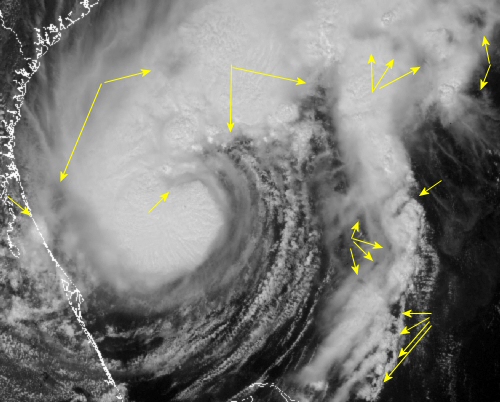
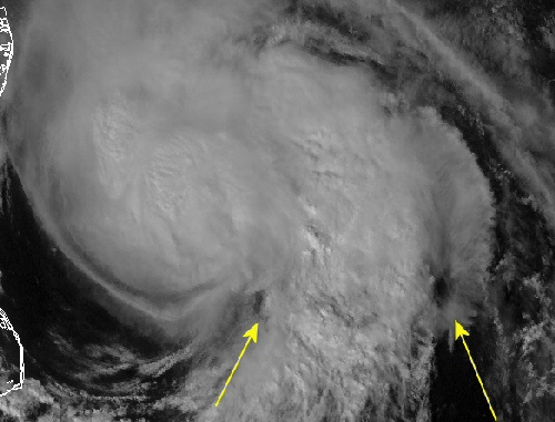
9 September 2005 1735Z
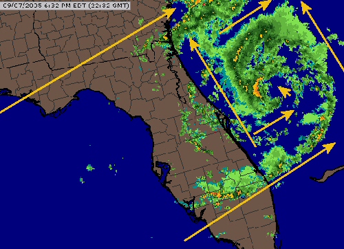
Radar Composite of Ophelia 7 September 2005 2239Z
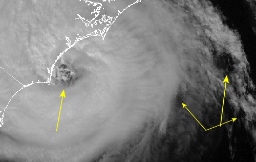
What a square storm she was! Ophelia was bound by straight lines composed of thunderstorms as the eye, the center arrow, is itself inside smaller boxes.
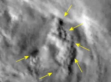
Ophelia 10 September 2005 2032Z
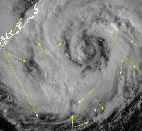
More deep holes surround what is supposed to be the eye of Ophelia, yeah that is an eye, right! Nothing, nothing at all looks natural in here.
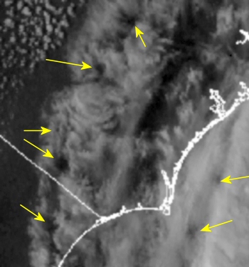
10 September 2005 2040Z
Exceedingly unusual shapes/patterns found in the western cirrus shield of Ophelia as she churned off the South Carolina coast. Does anybody else see these unusual holes? I haven't pointed out nearly all that is odd within this image either!
14 September 2005 1815Z
This was just as Ophelia was tracing the exact path of the North Carolina coastline. And I do mean she moved from Myrtle Beach, South Carolina to Southport/Wilmington, N. C. up to Morehead City before pausing. The precision of this movement is a clear demonstration of what these guys are capable of! Do you see the anti-eye, it is arrowed and well off the the east?
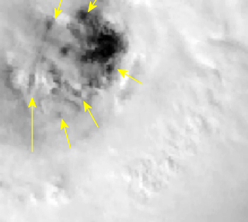
12 September 2005 2046Z
A messy eye with numerous energy imprints... Three holes in north/south orientation along the western part of Ophelia.
14 September 2005 1945Z
Additional classic scalar geometry is seen within the eye of this category one hurricane. More holes used to make a square which will deform to make an eye like feature. Do you see the developing track that will connect the two westernmost arrowed holes?
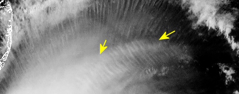
16 September 2005 1815Z
Roughly seventy-five to 90-degree bends in the high level cirrus outflow highlight the gravity waves/scalar waves of energy fields to maintain the upper level outflow and hence the angular momentum of the storm.
16 September 2005 1910Z
Ophelia looks more like a squid than a tropical storm! These monster holes/eyes are used as guides for these storms. These holes are present in nearly all clusters of thunderstorms whether or not they are associated with a tropical storms. Check out the July satellite imagery page for more examples away from the tropics.
17 September 2005 2115Z
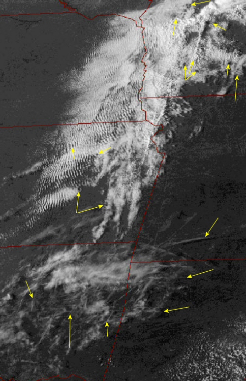
Hundreds of miles of rippling clouds across Kansas and eastern Nebraska countering/working against a strong southerly low level flow of heat and moisture ahead of an inbound fall storm from the north Pacific. Gently nudging the storm in a slightly different direction as compared to what would happen naturally. Note the prolific marking contrails from the Ozarks of Missouri/Arkansas and all of eastern Oklahoma.
17 September 2005 Kiefer Oklahoma ~10:15am/1515Z
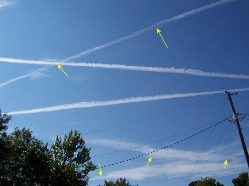
Prolific marking of the skies across portions of the southern plains this past Saturday as the chemtrail marking planes grid the morning sky in their unending search for energetic anomolies altering the atmosphere. These trails are marking the boundaries of this scalar energy interference. If you see these planes and this type of contrail behavior in your skies, something is certainly happening!