Recent News Stories and Chemtrail Plane Images
30 November 2005
Failing ocean current raises fears of mini ice age
The ocean current that gives western Europe its relatively balmy climate is stuttering, raising fears that it might fail entirely and plunge the continent into a mini ice age.
The dramatic finding comes from a study of ocean circulation in the North Atlantic, which found a 30% reduction in the warm currents that carry water north from the Gulf Stream.
The slow-down, which has long been predicted as a possible consequence of global warming, will give renewed urgency to intergovernmental talks in Montreal, Canada, this week on a successor to the Kyoto Protocol.
Harry Bryden at the Southampton Oceanography Centre in the UK, whose group carried out the analysis, says he is not yet sure if the change is temporary or signals a long-term trend. "We do not want to say the circulation will shut down," he told New Scientist. "But we are nervous about our findings. They have come as quite a surprise."
The last shutdown, which prompted a temperature drop of 5°C to 10°C in western Europe, was probably at the end of the last ice age, 12,000 years ago. There may also have been a slowing of Atlantic circulation during the Little Ice Age, which lasted sporadically from 1300 to about 1850 and created temperatures low enough to freeze the River Thames in London.
Journal reference: Nature (vol. 655, pg. 438).
Failing ocean current raises fears of mini ice age
______________
Hurricane Season Refuses to Blow Over
The record-breaking North Atlantic hurricane season of 2005 just will not end -- and it may get worse yet, say meteorologists as yet another storm has surfaced in the Atlantic and the remnants of Tropical Storm Delta blow towards Africa.
On Monday, Delta blew across the Canary Islands on its way towards Morocco. The US National Hurricane Center predicts its remains may reach northern Mauritania on Tuesday.
But this highly unusual transatlantic crossing does not wrap up this already-record-breaking season, which officially ends Wednesday. On Tuesday meteorologists at the NHC named tropical storm Epsilon, which is the record 26th tropical storm of 2005.
Meanwhile, the centre's annual re-analysis of the storm
season may lead to upgrading of the peak strength of July's Hurricane
Emily to the most intense class, Category 5, says NHC forecaster Stacy
Stewart. With Hurricanes Katrina, Rita and Wilma all recorded as Category
5 storms, 2005 already holds the record for three such powerful storms
in one season. The total of 13 hurricanes is also a record for the North
Atlantic hurricane season.
Look East
Delta was an unusual storm in an unusual season. Hurricanes typically form between the Cape Verdes Islands off Africa and the Lesser Antilles north of Venezuela, then move west into the Caribbean and Gulf of Mexico.
But Delta formed north of the usual hurricane zone as an "extratropical" storm, with a cooler core and a different circulation pattern than tropical storms which form over warm water..
_______________
Can Earth's seismic radio help predict quakes?
So far, however, earthquake prediction has proved an elusive art: no one has worked out how to read Earth's vital signs to provide accurate warnings. But there is hope. Among the welter of dead ends - from monitoring animal behaviour to measuring radioactive gas emissions or the flow of groundwater - a new bellwether is coming to the fore: electromagnetic radiation.
Prior to some recent quakes, scientists have detected electromagnetic pulses emanating from the ground and electromagnetic disturbances in the ionosphere, the planet's tenuous envelope of charged particles extending from about 80 to 1000 kilometres up. "There are definitely hints of something [electromagnetic] happening in the region of earthquakes before the earth moves," says Colin Price, a geophysicist at Tel Aviv University in Israel.....
Quakes' telltale radio signals were first rumbled almost 20 years ago, following an accidental discovery by Anthony Fraser-Smith of the Space, Telecommunications and Radioscience (STAR) Laboratory at Stanford University in California. During the Loma Prieta earthquake that hit the San Francisco area in October 1989, Fraser-Smith was monitoring electromagnetic noise at frequencies up to 10 hertz. He noticed the electromagnetic noise increased almost 20-fold for two weeks before the earthquake - and continued at that level about a month afterwards. It peaked 3 hours before the quake, between 0.01 and 0.5 hertz.
Since then, others have tried to make similar measurements in seismically active regions. Groups in Japan and Russia have observed similar signals to Fraser-Smith's, but for up to one or two months before a quake. Could this be the long-sought early warning of seismic catastrophe?
On 4 January 2004 the system began detecting ULF radio pulses coming from the south-east. Two days later, a magnitude-5.5 quake struck the area, with an epicentre 130 kilometres away - to the south-east. Six hours after the quake, the ULF signals spread out, arriving from both the south-east and south-west, and died off the next day... This year it observed similar disturbances two days before the 23 January quake in Indonesia and five days before a quake on 30 August near Japan, and last November two days before a quake close to New Zealand.
From issue 2526 of New Scientist magazine, 18 November 2005, page 28
http://www.newscientist.com/channel/earth/mg18825266.900
My question is this: Are these sound waves truly originating from the planet? Or are these ULF waves a by product of the scalar weaponry at work much as the Russian Woodpecker grid can be heard in the 3 to 30 MHz range over short wave radio?
_____________________________
In the meanwhile the planes are hard at work!
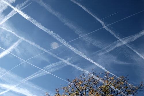
Chemtrails Masquerading as Contrails
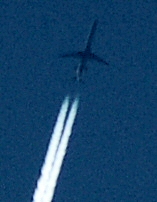
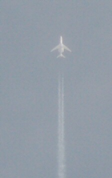
November 3, 2005 Over Lexington, Kentucky--Chip Swetnam
It is the cold season when the contrail-chemtrail activity appears to be the most active across both Europe and North America. Why? There are two primary, but not exclusive reasons, for the introduction of these chemicals into our atmosphere. The first is that of a marking program where by these contrail lines are crisscrossed through the sky at varying altitudes looking for locations where weather modification is underway. The resultant behavior of the chemtrails then provides a directly visible and measurable value to the extent of the electromagnetic (EM) interference. This is an ingenious method of atmospheric surveillance developed and deployed more than 10 years ago. I can't believe that I didn't see it for so long!
This program is far more intensive (and expensive--thank goodness for the Fed's printing press) than the balloon releasing or radiosonde program that The National Weather Service uses to accomplish its--by comparison-- rather crude attempts at remote weather data gathering. Leave it to the military and black ops to do the job on a grand scale!
The second reason these chemicals are delivered into very precise locations within this scalar-electromagnetic weather grid appears to be that of adhesion. While reviewing many many hours of time lapse imagery of the skies that reveals the flight paths of these planes; it becomes rather apparent that these electrically conductive elements are introduced at special energy locations where a thin layer of chemclouds then forms. These clouds then provide a small platform whereby the actions of this EM-grid can be made visible. These clouds will stand nearly motionless while clouds located in the other layers of the atmosphere will move on by. Again, these clouds provide visual markers of the EM activities in our skies.
I took the two pictures seen below that illustrate rather nicely the fine rippling made visible by these wholly artificial clouds. The chemical cocktail needed to create these clouds is already profoundly impacting the health of each of us individually, our families and lastly that of the entire planet's ecosystem. Pay attention to upper respiratory infections and the rampant increase in allergies across all seasons. In addition, long term exposure to genetically modified foods cannot be helpful to the human body in this brave new world. Using proper natural whole foods--like bananas--to chelate these metals from our bodies which is necessary to remain healthy for long periods of times. Potassium included in fruits and vegetables can go a long way in assisting the body in its efforts to keep you healthy of these chemicals that we involuntarily ingest and breath in daily. Drink plenty of water and abstain from diet sodas; artificial sweeteners just replace one poison with another. Aspartame Horrors
Below is a link to Clifford Carnicom's work on Ions and Humidity and the metals contained within these chemtrails. Plus a look at their conductivity in the relationship to the atmosphere's ability to conduct a current of electricity via these manmade clouds. Remember, clouds are now created electrically and movement across either the X or Y axis remains necessary to develop these clouds into any substantial size or mass. Rotation of even the lowly cumulus cloud is necessary to bring it into manifestation when the natural atmospheric environment would dictate that the sky should remain clear.
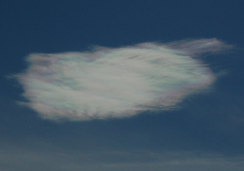
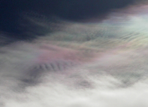
Both Images are from November 10, 2005 Pocatello, Idaho
Those persons, that are in the know, belonging to our various World Governments will likely never acknowledge this chemtrail program because to do so will reveal their closely held portfolio of energy based weapons & tools. Their 'God' weapons. They have killed and will kill to keep these secrets and us ignorant. They count on the public not being curious about their environment, they count on the arrogant mainstream press not jumping into this investigation; though there are now cracks in their persistent silence. Most of all The Powers That Be count on getting to the 'end game' before the truth is demanded of them or their safety threatened. But most importantly, before you figure out how to empower yourself and quit being willingly made a victim.
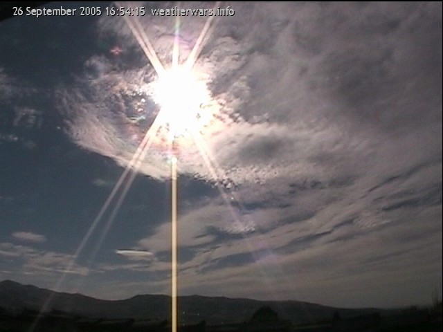
26 September 2005 Pocatello, Idaho
This view is from one of my time lapse cameras that is perched out of an upstairs window that looks toward the west-south-west across the city of Pocatello. The cameras are Canon ZR300's that capture single frames at four second intervals using Willing Web cam or CaptureMAX software to build the resultant avi's. These movies consist of 8800 frames during the winter months while needing up to 14,500 frames during the longer summer days. The full movies consume 500-630Mb of storage space during the winter and upwards of 780 to 1050Mb come summer.
Notice the milt-colored chemclouds that form and then stand still while scalar waves ripple on through.
This particular clip runs 73 seconds in length.
Small file at good quality 360x240 1.96MB
Two more time lapse movies are at the bottom of this page.
I use Apple's Quick time format because of the ability to page through these movies frame by frame using the arrow keys as input. Microsoft's media player is just too clunky and frustrating to use when I want to scan through a video file at various speeds either forward or backwards.

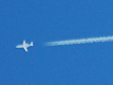
Chemtrails Planes Creating a Dispersion Trail
November 11, 2005 Over Chicago Illinois
I have received a few emails from those who see the images of holes in the clouds and assert that these holes are where planes have seeded the local environment precipitating a 'dispersion hole' in the overcast. Yes, this can and does happen. However, the holes I feature are not caused by aircraft punching through clouds. The above image is an exquisite example of such a dispersion trail. Heat, turbulence, and increased condensation nuclei have caused the existing cloud cover to mix-out creating an inverse appearance when compared to the more common contrail-chemtrail created cloud cover now seen virtually world wide.
This deck of clouds maybe very similar in composition to the second and third images on this page that I shot on November 10th here in Idaho.
November 18, 2005 8:06am Pocatello, Idaho
A morning contrail, not more than 75 seconds old, has been carefully threaded through a grid-work of scalar acceleration ripples so as to ascertain the locations and the physical extent of the Weather Engineering Program. Beautiful, isn't it?
The next day..
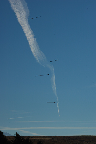
19 November 2005 12:35PM Looking South here in Idaho
Occasionally we get days when the planes are contrailing aggressively from before first light until well past dark. Day or night is irrelevant to this program; the contrails will be seen from space regardless of lighting conditions as they are chemically very different from natural clouds. This particular trail is one of the persistent marking trails used to observe how the atmosphere is reacting to the scalar energies being introduced at numerous locations. Note how the upper part of the contrail is strongly tilted off to the east/left. The contrail then resumes its north-south orientation at the first of two areas of clearing (which are arrowed) indented from the east. Other aircraft then come along and mark these locations with the non-persisting contrail mixture.
This day was gorgeous here in the Mountain West as afternoon highs exceeded 63F/17C which is well above the typical highs for the third week of November. Just off to the east--by about 500 miles--a strong Alberta Clipper impulse was rippling south-bound setting the stage for the early snows that fell across the Eastern US over Thanksgiving weekend. That Clipper needed a monster high pressure to 'fall off of' and that was why the contrailing occurred out West that day. To measure the warmth being added to specific layers of the atmosphere adding volume and height of which this Clipper could get a push off.
Contrast. Contrast in temperature, in moisture, pressure, electrical fields all of these are variables that that when a great change in value, delta, is present over a short distance presents an enhanced opportunity for a storm to develop. Artificially create this contrast in conditions and the result is an increase the power, the intensity, of a storm.
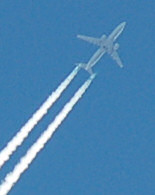
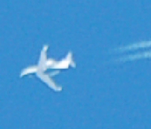
This above trail was laid down by the MD-90 aircraft pictured six images below.
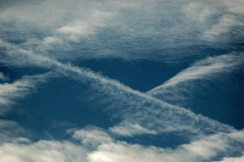
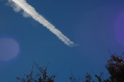
Rippling in the atmosphere marked by a contrail.
Do these contrails assist the scalar grid with its 'work' via an adhesion factor to the grid? Or are the contrails used just to make these waves visible to the eyes? Remember that aircraft with passengers avoid flying through the clouds... Clouds equate to turbulance.
Adhesion of this chemically laced air to the 'Grid' may give us some oddly shaped clouds..
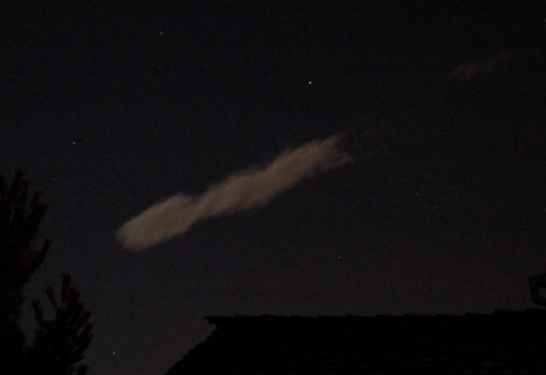
November 10, 2005 11:16pm A f5.6/4-second exposure Looking West from my home here in Idaho. It was cool to watch this cloud corkscrew while standing in place.
______________________
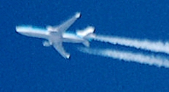
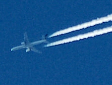
A collection of chemtrail depositing aircraft that I have seen here in the Mountain West.
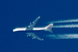
A Boeing 747 and a 767 both equipped with wing lets allowing for greater lift than what is possible with just a typical blunt end wing tip. There must be a paint job contest to determine which colors and schemes will allow for the greatest concealment of these planes and their interface with the attendant contrails so as to keep them hidden in plain sight. There is also the close approximation of these paint schemes to commercial carriers so that at a distance these guys don't stand out too much.
First captured overhead and then flying off to the south, vector 180, with the late days sunshine illuminating the western facing side of the fuselage. There are no North-South/180 commercial airways out here.
http://www.boeing.com/commercial/767family/background.html
From the above link go look for the tanker transport data towards the bottom of the page. It is a pdf file.
Boeing The Boeing MD-90 is an advanced mid-size, medium-range airliner that serves the needs of travelers and airlines today and well into the 21st century. The aircraft, one of the quietest large commercial jetliners in the skies, belongs to the twinjet family of aircraft that started with the DC-9 and includes the Boeing 717 and MD-80. Boeing MD-90's The Boeing MD-90
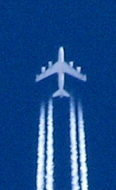
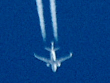
Chemtrail planes flying over my house here in Idaho. Pictures shot with my Nikon D50 and a 300mm Sigma telephoto lens.
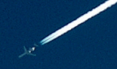
For lower altitude operations smaller business jets do the job nicely. Whether they be Cessna Citations, Gulf stream's, or Dassault Falcon's--the jet on the right, these smaller craft have a part to play in working various altitudes of this contrail marking project.
Rarely have I seen the smaller craft participating in this program lay down the thick marking contrail/chemtrail like the one seen below.
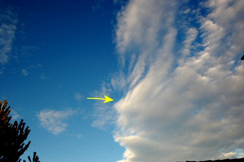
This chemtrail just ends.. In doing so it provides a marking of a boundary of a different atmospheric ionization environment. Possible, but less likely, is that of a zone of differing moisture content. Seen from my back porch here in Idaho this past November 2005.
12 November 2005 2042Z 1:42pm MST Pocatello, Idaho
Odd looking holes. Sometimes clouds are helpful in outlining the underlying cumulative forces of Orgone energy; the force that provides the basic geometric structure of the atmosphere. Scalar waves deform and at times enhance the natural geometry that underlies atmospheric processes.
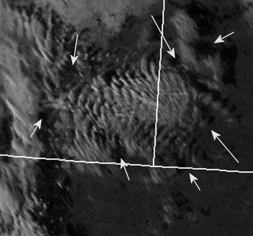
29 Nov 2005 2201Z 5:01pm Central.. SW Nebraska/SE Wyoming/NE Colorado
The arrowed holes are marking clear zones which seem to be energy inflection points. This terrain is on the eastern edge of the Rockies so I would expect to see some kind of effect in the clouds from the mountains to the west, but this display of wave clouds is just out of control! This image spans, at most, 230 miles in the east to west direction and the lower centermost arrow is essentially over Cheyenne Wyoming.
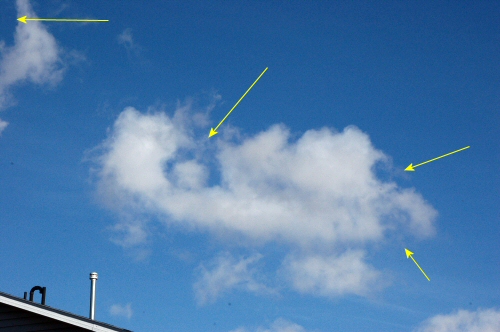
10 November 2005 1457Z/7:57am Mountain Pocatello, Idaho
This is what one of the much smaller energy inflection points looks like from below. Note that at the point of the arrow there is a bight cloud just below with the compliment clear hole just above. Symmetry.
___________________________________________
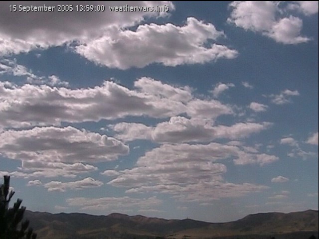
15 Sept 2005 2.6Mb
This view is to the southwest with the excerpted clip just under 30 minutes in length. In general, and to the casual viewer, these clouds represent the typical late summer cumulus build-up that are so common once daytime heating is firmly in place. Pocatello lies on the southeastern edge of the Snake River Plain (SRP) which is a rather wide valley that features undeveloped high-desert sagebrush, some flat reaches of two millennia old lava-flows and some developed irrigated agricultural acreage that generally lies to the north and west. To the east and south are mountains with peaks generally less than 9,500'. So my city lies on the interface between this mountainous terrain and the open valley to the northwest.
On this particular day two weather energy grids are grinding against each other as the general weather pattern would have the clouds developing vertically and slightly to the left. Play back the movie. Then using the slider bar you can see that these clouds can get very little vertical development as they are pushed strongly toward the right and left. The clouds develop strongly upward at their base then get sheared off at the top as they run into some strong lateral resistance as vertical development just cannot happen. It is like watching two screens being slid across one another. Also, note the rapid rotation of the cumulus clouds; it is not the bubbling action of a rising parcel of warm air that creates these clouds as we are so diligently taught. Again, I come back to this aspect of rotation and attendant electrical fields being created by the rotation as a necessity to develop the electrical field first then the moisture is attracted by the charge generated by rotation. then finally, we have cloud manifestation.
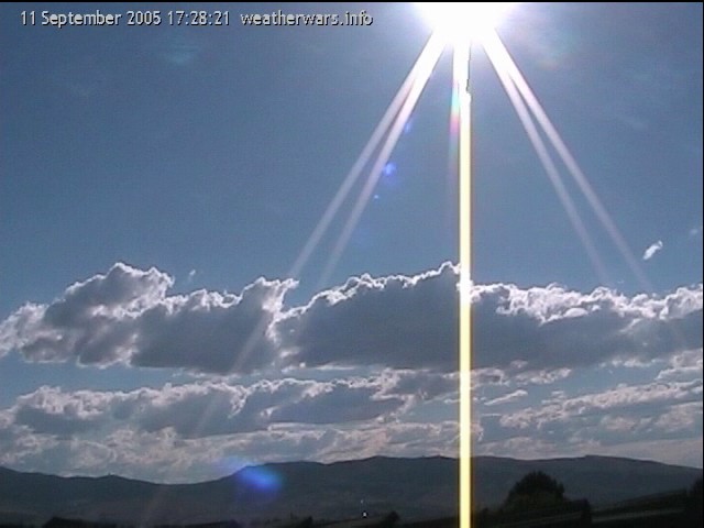
11 Sept 2005 2.4Mb
Another day when wind speeds--or the moment of the grid--not too far above the cumulus cloud tops, result in shallow vertical development of the clouds which then rotate and tip over to the right/north. When these strong 'pushes' occur a thin shield of a cirrus-like cloud results. These clouds are seen forming at 17:41 at lower center frame then again below the sun at ~17:51. Colors in these clouds closely resemble the chemicals released via the contrail planes. These clouds seem to represent a highly electrical environment.
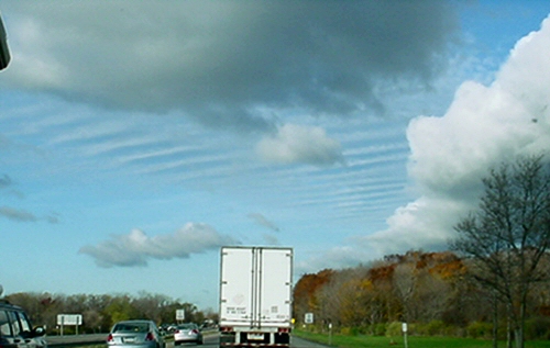
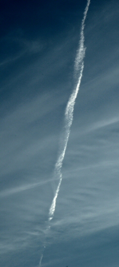
This image was sent to me by a reader who was traveling westbound toward Buffalo, NY at exit 49. The rippling is pronounced as the sky is being adjusted ahead of these past Thanksgiving weekend storms.
My appreciation goes out to all of those who have shared with me their stories and pictures, all of varying quality I might add. It is only when We the People, the hundreds of millions of us, demand honesty and accountability of and from our governments that progress will be made in uncovering these unspeakable crimes against our planet and against each of us collectively. When governments have to power to play God then these must be honorable institutions, honorable above reproach. Today, at least, this is not the case. I would doubt that at anytime in the past has this corruption been so blatantly flaunted in front of the people. The Universe will find balance -- as it always has. The pendulum has begun to swing back into our favor. What will you do to take advantage of this change in momentum to make this world of ours a better place to live?
As always, keep looking up!
--Scott Stevens